The Lower Inferior Oolite (Aalenian) Of The Cotswolds: Towards A Sequence Stratigraphic Framework
Field seminar to examine facies variation and sequence stratigraphy in Jurassic (Aalenian) oolitic carbonates
Location
Along Cotswold escarpment to the North and South of Cheltenham
Objectives
This field seminar is intended as a hands-on exercise in building carbonate sequence stratigraphic models at the petroleum reservoir scale.
Who Should Attend
This seminar will be of interest to geoscientists wanting to gain a practical understanding of the principals of carbonate sequence stratigraphy. It is particularly appropriate to those involved in carbonate reservoir development geology. Special emphasis is placed on the identification and characterization of bounding surfaces and on cycle stacking patterns.
Geological Setting
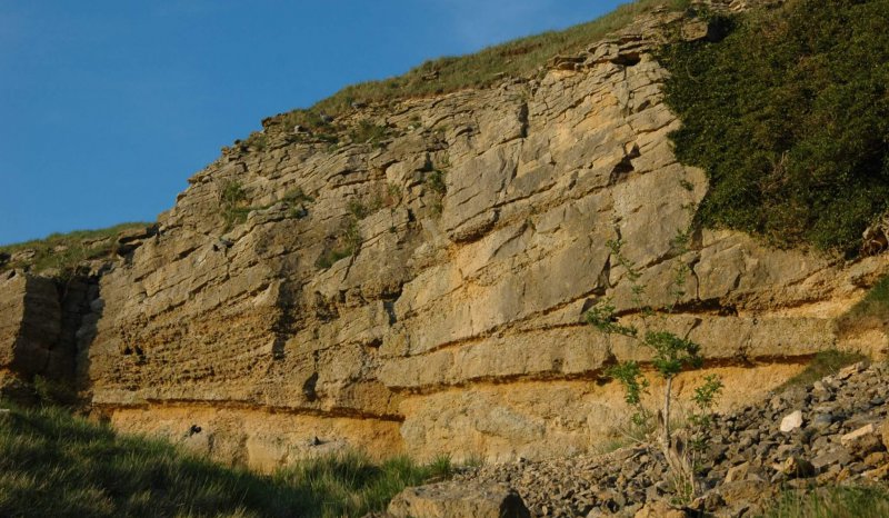
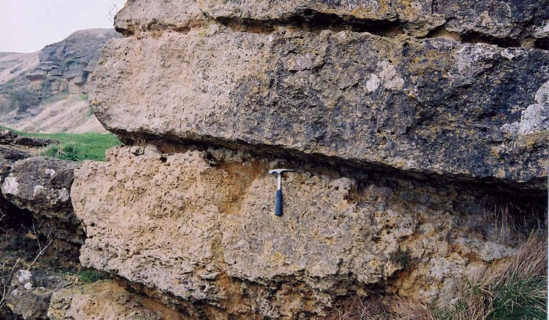
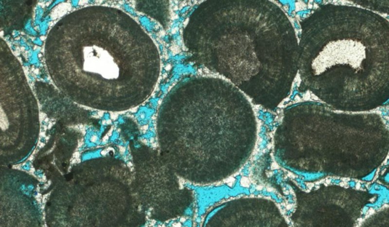
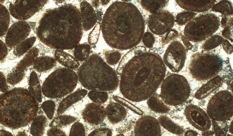
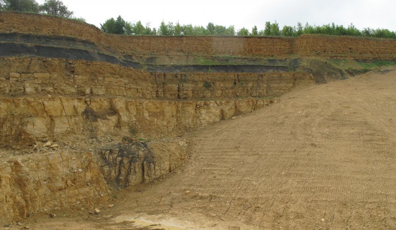
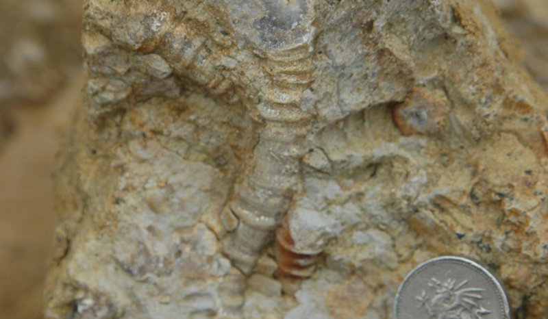
The Lower Inferior Oolite (Aalenian) of the Cotswolds accumulated within the Worcester Graben, a probable Triassic structure bounded to the west by the Malvern Swell and to the east by the Vale of Morton Swell and London-Brabant massif. During Aalenian times this graben was the site of a narrow tidal seaway linking the Wessex-Channel Basin to the south with the Anglo-Dutch Basin to the northeast. A 50m-thick succession of oncoid- and ooid-prone offshore shoal facies was deposited along the basin axis which extended from Cheltenham to Cirencester. Water depths were probably no more than a few tens of meters given the extreme paucity of ammonites. The succession thins toward the western flank of the basin where oncoids are notably absent and where quartz sand-prone ooid-shoal facies predominate. A thin terminal package of paralic sands and shales (the 'Harford Member') of Late Aalenian (?earliest Bajocian) age is largely confined to the basin axis.
Course Format
This field workshop does not follow the usual "show and tell" format. Participants are encouraged to make their own observations and sequence stratigraphic interpretations based on a limited dataset, poor biostratigraphic constraint and indifferent exposure (i.e. a real life situation!). This as an exercise in building a sequence stratigraphic model on a field development scale, with the isolated outcrops equivalent to cored well sections, and the published literature corresponding to contractor's reports of variable vintage and quality. Only a few regional 2D seismic lines and gravity profiles are available, and wireline data are confined to just a few well penetrations. Participants are provided with a detailed field guide, which presents relevant datasets and a geological overview of the area.
Course Details
-
Duration: 2 to 3 days
-
Proposed dates: to be arranged
-
Cost: By quotation, includes instruction, accommodation and a comprehensive field manual.
-
Clothing: participants should be equipped with stout walking boots and waterproofs. Safety helmets are mandatory at quarry localities
-
Insurance: participants should ensure that their employers liability insurance cover (including medical insurance) is in order, particularly for personal accident and loss or damage of equipment, as Oolithica Geoscience Ltd cannot accept responsibility for claims arising from this or any other field seminar.
-
Attendance Limit: minimum 7, maximum 15 participants