The Petroleum System of the Wessex Basin: A Field Workshop
The Petroleum System of the Wessex Basin: A Field Workshop
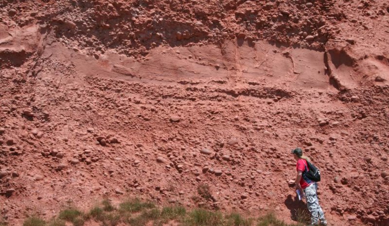
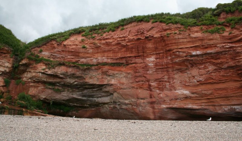
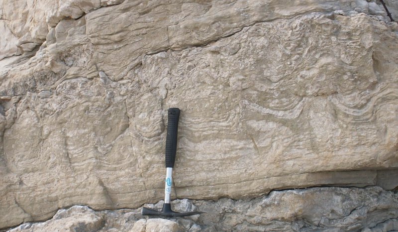
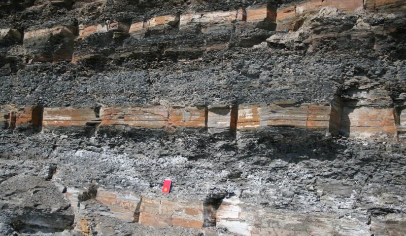
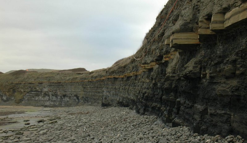
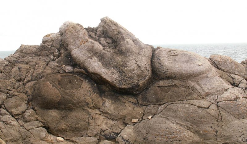

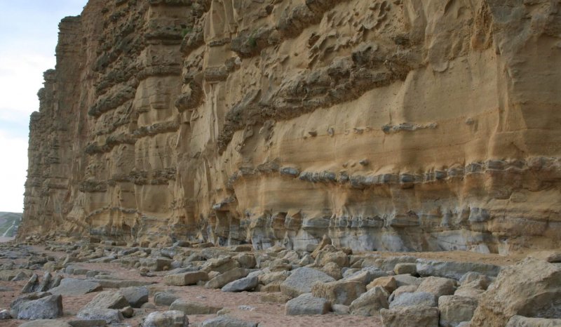
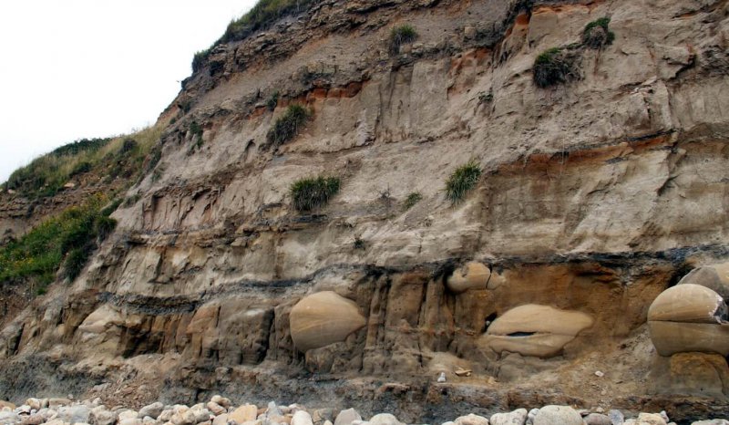
Field Seminar to examine all the elements of a working petroleum system from the Permian to Cretaceous, including the lacustrine microbial carbonates of the Purbeck. The area studied contains a number of oil fields sourced from Lower Jurassic source rocks. The trip examines the Lower Lias and Kimmeridgian source rocks, Triassic and Jurassic reservoir sections, active surface and palaeo oil seeps, the structural history of the area and concludes with the examination of well exposed Purbeck carbonates.
Objectives
The aim of this seminar is to examine the critical components of a petroleum system:
-
Source rocks
-
Maturation
-
Reservoir rocks
-
Seals
-
Traps
Who Should Attend
This seminar will be of interest to geoscientists wanting to gain an understanding of the principals of carbonate sequence stratigraphy. It is particularly appropriate to geoscientist involved in the development of analogue carbonate reservoirs.
Geology
The Wessex basin forms part of a larger intracratonic basin system that spanned much of the southern England, the English Channel and northern France. Underlain by pre-Variscan basement, it is believed to have had its origin in the Permo-Trias rifting that affected much of the northwestern Europe. The basin underwent further phases of extension during the Jurassic, prior to modification by uplift and tilting in the late Cretaceous and subsequent Alpine inversion events during the Tertiary.
The Wessex basin itself can be subdivided into a number of component parts represented by a series of sub-basins and paleohighs. The 'Pewsey fault System' and the 'Central Channel High' define the northern and southern margins of the main basin, respectively. The Purbeck-Isle of Wight Disturbance, together with the underlying Mesozoic Purbeck-Isle of Wight Fault system, effectively separates the Portland Wight Basin from the South Dorset Shelf and Hampshire-Dieppe intra-basinal highs. Further intra-basinal structural elements include:
-
The South Dorset Basin (Winterbourne Kingston Through), bounded by two E-W trending extensional faults, within the South Dorset Shelf.
-
The Wardour and Portsdown Fault Systems, representing important intra-basinal growth fault sets, prior to reverse reactivation in the Tertiary.
-
The Watch-Cothelstone-Hatch Fault System, which transects the basin largely in subsurface, trending NNW-SSE.
Course Format
This field workshop does not follow the usual "show and tell" format. Participants are required to make their own observations and sequence stratigraphic interpretations based on a limited dataset, poor biostratigraphic constraint and indifferent exposure (i.e. a real life situation!). Participants are encouraged to consider this as an exercise in building a sequence stratigraphic model on a field development scale, with the isolated outcrops equivalent to cored well sections, and the published literature corresponding to contractor's reports of variable vintage and quality. Only a few regional 2D seismic lines and gravity profiles are available, and wireline logs are non-existent. Participants are provided with a detailed field guide, which presents relevant datasets and a geological overview of the area.
Course Details
-
Duration: 3 days
-
Proposed dates: to be arranged
-
Cost: By quotation, includes instruction and a comprehensive field manual.
-
Clothing: Participants should be equipped with stout walking boots and waterproofs. Safety helmets are mandatory at quarry localities.
-
Insurance: Participants should ensure that their employers liability insurance cover (including medical insurance) is in order, particularly for personal accident and loss or damage of equipment, as Oolithica Geoscience Ltd cannot accept responsibility for claims arising from this or any other field seminar.
-
Attendance Limit: minimum 8, maximum 15 participants.